Part of the reason we delayed writing this final blog entry about our big move back to Oregon is because it felt like capturing it in a blog entry would really close the door on the "East Coast" chapter of our family's life . . . and we were a little sad that it was ending.
(And admitting that doesn't mean we aren't also SUPER happy to be back home and reconnecting with family and friends!)
What we have come to appreciate since being home is that our time on the East Coast has given us a broader perspective and some life lessons that will always be with us, among them the "carpe diem" spirit and our family's sense of adventure. We learned a lot about ourselves, and perhaps most importantly, we discovered that our kids are a lot more resilient than we thought they would be . . . not just surviving but actually thriving during our time away.
Life always keeps moving on to the next thing, whether you acknowledge it or not. Before we forget the details, it's time we share a retrospective on the pack out, move and our epic nine-day, 3374-mile, "Westward Ho!" cross-country adventure that brought us back home to Oregon. For those of you who want to join us on the ride, read on . . . .
* * * * * * * * * * * *
Part 1: Preparing for Launch
In 1803, Meriwether Lewis and William Clark were tasked by President Thomas Jefferson to lead an expedition up the Missouri River in search of a water route to the Pacific Ocean. In planning our journey home (and in a nod to our namesake, Lewis & Clark's "Corps of Discovery"), we decided we would endeavor to follow in the footsteps of the their Expedition and see as many of the key historic sites from their journey as we could squeeze in along the route home.
Remember these (mentioned in a recent blog post on our last visit to Monticello)?
 |
| Bicentennial Geodetic Marker |
Thankfully, their footsteps would be easy to follow and well marked with these Lewis and Clark Corps of Discovery Commemorative Disks. They are actually geodetic markers that were placed by the National Oceanic and Atmospheric Administration (NOAA) during the bicentennial celebrations that took place between 2003 and 2006.
With our route home planned, we turned our attentions to other preparations that had to be made before we could launch on our epic "Westward Ho!" adventure.
Thankfully, we didn't have to build a fort like the original Corps of Discovery and winter over while we acquired supplies for the journey. In these modern times, we were fortunate enough to receive assistance with packing and loading
and we were able to send our stuff ahead to our ultimate destination!
 |
| Thanks for the help, Uncle Sam! |
Although Captain Meriwether Lewis's big black Newfoundland "Seaman" accompanied the Corps of Discovery on their expedition, we decided to NOT have our faithful companion, a big black lab named "Spike," accompany us on the journey west because of the heat and because of some health challenges he'd been having. Spike got to fly home in air conditioned luxury, and he spent about 10 days being pampered at Gramma C's house . . . lucky dog!
 |
| Spike ready for his big adventure |
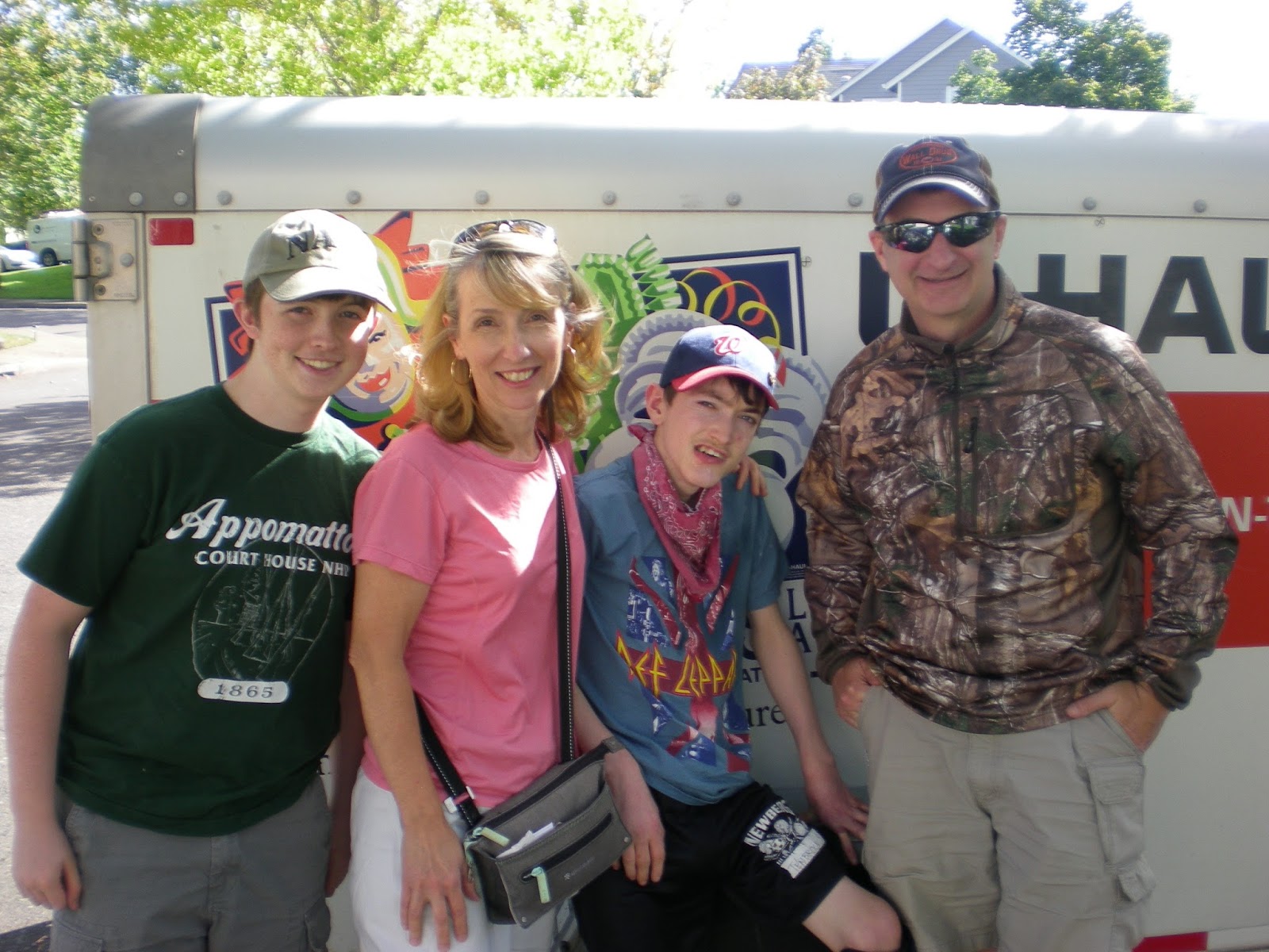
Last but not least, we had to acquire our modern-day version of a “keel boat” to carry our most prized possessions and the essential supplies we would need both on the journey west and in the weeks after arriving at our destination, in case the rest of our possessions did not arrive in a timely fashion.
Apparently it was college weekend in Northern Virginia, so U-Haul "keel boats" and other such equipment were in very short supply . . . and also fetched a handsome price from helpless consumers. We were finally successful in renting a suitable vessel for an exorbitant price just a few hours before we had to give our landlord the keys to our temporary home away from home.
Unlike the affectionately-named "Rusty Scupper" used on our journey East, this vessel was a full on LAND BARGE with no gas-mileage-sparing aerodynamics whatsoever, but it had good tires and plenty of room and we cheered our good fortune that we were able to get one at all!
 |
| Land barge in tow |
Part 2: Heading West
 |
| Modern day gizmo to keep us headed in the right direction |
Day 1--Fairfax, VA to Lexington, KY
The day of our departure dawned sunny and bright. Our spirits were high as we stowed the last of our possessions in the land barge and set sail away from the Residence Inn in Fairfax, VA.
We pulled into the current with the other weekend travelers on I-66 and headed due west. An hour later, we said our goodbyes to the beautiful Shenandoah mountains that we had visited so many times and took I-81 down the Shenandoah Valley, crossing the Blue Ridge Mountains into West Virginia.
Quite honestly, the rest of the drive through West Virginia was a bit of a blur . . . most memorable were the coal mining operations (still a huge industry there) and the vast and endless fields of CORN. At some point we got on I-64, which would take us all the way into Missouri.
The Ohio river figured big in Lewis & Clark's initial journey west, so we stopped briefly in Huntington, WV (home of Marshall University--"We are Marshall" for those of you fans out there) to get a glimpse.
There was a Corps of Discovery commemorative marker in David Harris Riverfront Park, right on the West Virginia side of the scenic Ohio River, looking across at the great state of Ohio. Sadly, we were thwarted in our attempt to see it because the local "Rails & Ales" festival and a lack of trailer parking kept us from disembarking to track the marker down. We saw the river, though, and got a sense of the place before getting back on the road.
 |
| Cloudy skies as we went through Charleston, WV |
We made it through West Virginia and arrived at our first night's lodging in Lexington, KY . . . horse capital of the world (!). . . just as the sun was setting, having driven 542 miles on our first day. Perhaps more noteworthy, we stopped for gas THREE times. The land barge really took a bite out of our usual fuel economy!
Day 2--Lexington, KY to St. Charles, MO
 |
| Kentucky corn as far as the eye could see |
We were chomping at the bit and eager to get started that second day. We hit the road and drove through Kentucky for what seemed like hours past vast fields of corn that alternated with vast horse estates, orderly paddocks and barns that were as nice as houses!
The other thing we noticed as we chugged along was that there were LOTS of motorcyclists riding on the freeway without helmets. Who knew that other states didn't have helmet laws?!? And who in their right mind would ride a motorcycle without a helmet? Apparently a lot of people based on the numbers we saw that day.
Although tempting, we resisted taking a detour to check out the Kentucky "Bourbon Trail," and before long we were crossing the Ohio River at Louisville, KY, which reminded us of Portland because it had a nice waterfront with riverboats and lots of bridges.
When we got to the other side of the Ohio River, we found ourselves in Indiana, the Hoosier state.
After driving a few more hours, we finally arrived in Hartford, IL, the location of our first significant Corps of Discovery historic site!
 |
| Lewis, Clark and Seaman |
The Lewis & Clark State Historic Site at Camp River Dubois, where the mighty Mississippi and Missouri rivers join together, is considered to be the point of departure of the Lewis & Clark Expedition.
 |
| Marker at Camp River Dubois |
It is here where Lewis & Clark built a fort as their winter camp and spent the winter of 1803-04 preparing for the journey.
It wasn't easy to find, but we did eventually locate the Corps of Discovery marker buried in the grass out by the winter fort.
 |
| Another geodetic marker! |
The State Historic Site had a great Visitors' Center, and consequently we spent quite a bit of time in there!
 |
| Replica of a Keel Boat on display |
We also learned a few fun facts!
Fun fact: Many of the members of the expedition were soldiers, and daily army rations in those days included a pound of salted beef or pork, beans, bread or cornbread, and a gill (1/4 pint) of whiskey. The Corps of Discovery members supplemented their meals by hunting, fishing and trading with the local farmers.
Another fun fact: The Corps of Discovery spent more money on presents for the natives (clothing, blankets, weapons, tools, tobacco, whiskey, peace medals, etc.) than they did on any other category of items for the trips.
It had definitely seen better days, but there was also a replica of the winter fort and quarters the Corps of Discovery constructed within walking distance of the museum.
 |
| Replica of the winter fort |
 |
| Entrance to the Winter Fort |
The Corps of Discovery left Camp River Dubois on May 14, 1804, determined to reach the Pacific Ocean. Although they had no idea at the time, they wouldn't return for two and a half years! Their expedition journals and maps, a national treasure, contain detailed records of their trials, tribulations and triumphs along the way. It was pretty cool to be right there where it all began and imagining how those brave souls felt as they set out on their important journey. We felt very lucky to be able to walk in their footsteps and follow along!
When we were done at Camp River Dubois, we drove down the road to the Lewis & Clark "Confluence Tower," which was a tourist attraction erected at the confluence of the Mississippi and Missouri rivers.
 |
| Base of the Confluence Tower |
The tower has an elevator that lets you out at several different platforms to enjoy the view, culminating in a stop at the top, which is 150 feet above the confluence of the two great rivers where Lewis & Clark began their westward journey. What a great view! If you looked carefully, you could just make out the St. Louis arch in the distance.
 |
| Enjoying the view from the top |
We decided not to venture into downtown St. Louis to see the arch up close because we would have been in the evening rush hour traffic. Instead, we took the freeway around St. Louis to historic St. Charles, just west of the city, where we bedded down for the night. To top off another good day of travel, we ate at Texas Roadhouse, only a mile or two from our hotel and one of our faves!
Day 3--St. Charles, MO to Kansas City, MO
We awoke to rain the next day, which sadly put a damper on wandering around the quaint, historic downtown St. Charles.
We drove by the Lewis & Clark Boat House and Nature Center, though, and didn't let a little rain thwart our attempt to find the Corps of Discovery commemorative marker, which was located just outside the Boat House and near the river.
 |
| Commemorative Marker at the Boat House |
The Boathouse wasn't open, but we peeked in at the keel boats and other vessels they had in there. It was evident that these were the "real deal" and were boats that were actually used in reenactments on the river. Very cool!
 |
| Replica Keel Boat |
From St. Charles, we hit I-70 west and set the GPS for Cass County and Austin, Missouri, the final resting place of an ancestor we wanted to pay tribute to who had a long and distinguished military career during the Civil War.
Would you be surprised to hear that we saw a lot of CORN along the way? Unbelievable amounts of corn. Makes you wonder who or what is eating all this corn?!?
 |
| Missouri corn |
Too bad we didn't have time to stop and take in the Missouri State Fair as we were passing through Sedalia, Missouri. We did have a great Mexican food meal there, though!
It was completely off the beaten path, but we did finally find Austin Cemetery, where hubby's great- great-grandfather was laid to rest, a Captain in the Army who had fought in many Civil War battles including the Peninsular Campaign (several battles), Fredericksburg (Marye’s Heights), Chancellorsville, Gettysburg (Wheat Field), Wilderness, Petersburg, and later the Western Campaign (1865). He was wounded in the war but recovered and lived to be a ripe old age. We found the gravestones and paid our respects to all the family members buried there. Another powerful moment to be so close to the people and place that were important in hubby's family history. Awesome!
 |
| Epic quest successful--we found it! |
 |
| And a military marker, too! |
From Austin, we continued on to Harrisonville, the seat of Cass County, Missouri. The county courthouse and town square seemed to be from another time in small town America.
From there, we made a beeline for Kansas City, taking one of the many bridges there that cross the Missouri River and finally ending up at our home-away-from-home for the night near the Kansas City airport.
 |
| Crossing the Missouri River at Kansas City |
Part 2: Following in the Footsteps (the Missouri River)
Day 4--Kansas City, MO to Chamberlain, SD
What you don’t realize until you drive across the country is how much CORN is grown in the United States. Yes, it makes one think of how much HFCS (High Fructose Corn Syrup) we consume, but also how important corn is for the BioPharma industry (biofuels . . . like ethanol). Not only did we see vast amounts of land planted with corn, we also saw huge plants for processing the corn. It's hard to fathom how big an industry this must be, but if you're paying attention as you drive across the country, you'll get an idea.
From Kansas City, our journey up the Missouri River took us through NE Nebraska, where Lewis and Clark continued their exploration.
Our first destination on Day 4 was Fort Atkinson State Historical Park in Fort Calhoun, NE, which was just north of Omaha, NE.
 |
| Carving of the Peace medal given out by the Corps of Discovery |
Fort Atkinson, a military fort built in the 1820s, was the first US military post west of the Missouri River. It was originally identified as a good site for a fort by Clark during the Lewis &
clark Expedition.
 |
| Site of the first council with native tribes in 1804 |
The fort is located on a bluff above the Missouri River (which has since changed course and is three miles away), and although named "Council Bluff," it is not to be confused with the nearby town of Council Bluff, IA.
 |
| Walking up to the massive replica fort |
The fort was named Fort Atkinson after Col. Henry Atkinson, the commander of the Yellowstone Expedition, who constructed the fort in 1819.
In its heydey, the fort garrisoned over 1000 men and was the center of commerce for the fur trade. It played an important role in the opening of the western frontier by mountain men and fur traders.
When Congress failed to allocate the $3,000 needed for repairs, the fort fell into disuse and the Army realigned its forces to protect the more southerly routes west. Restoration of the site began in 1961 and continued over the next 20+ years.
 |
| We found it--the Corps of Discovery marker at Fort Atkinson! |
The Missouri River basically forms the border between Nebraska and Iowa. From Fort Atkinson, we headed north to our next stop, the Lewis & Clark Interpretive Center in Sioux City, Iowa.
This was a great museum, especially for younger kids, and it had a lot of sculptures on the grounds surrounding the museum building.
 |
| Huge sculpture of Lewis, Clark and Seaman |
We checked another Corps of Discovery commemorative marker off our list here, although this one was almost impossible to find as it was buried in the grass near the above statue, and the docents and other volunteers at the museum weren't any help because they had no idea the disk was even there. It made us a little sad that these markers weren't more well cared for.
 |
| We finally found it! |
Inside the museum, there was a cool expedition map, and the picture below shows you the portion we were doing (basically from Camp River Dubois in Hartford, IL to Chamberlain, SD, where they continued following the Missouri river into North Dakota and we continued heading west).
 |
| Our portion of the expedition |
Once we got on I-90 headed west (and even before), we started seeing signs for the famous "Wall Drug."
 |
| I-90 is so straight you don't need to hold the steering wheel! |
 |
| Crazy cloud formations/thunderheads |
If we had a "corn-o-meter" to measure the amount of corn grown in each state, South Dakota would have that thing pegged . . . to quote Will Ferrell, there's a "mind bottling" amount of corn being grown there. The most corn yet by far!
 |
| South Dakota corn |
We drove through Mitchell, South Dakota, home of the "Corn Palace," which is a tourist attraction and concert venue decorated entirely with corn on the outside.
 |
| Yup, that's a lot of corn! |
We stayed in nearby Chamberlain, South Dakota, that night, and drove in to our hotel parking lot just in time to see a spectacular sunset on the great plains. Chamberlain was pretty sleepy, but it is rumored to be the pheasant-hunting capital of the world.

Day 5--Chamberlain, SD to Rapid City, SD
We started our sightseeing in Chamberlain itself, at the Lewis and Clark Interpretive Center, which is basically a museum at a rest stop off I-90.
It had a great view of the Missouri River as it heads north into North Dakota. We managed to find the Corps of Discovery Commemorative marker, even though once again the museum staff didn't know anything about it being on site.
 |
| Another commemorative marker and beautiful overlook! |
This Interpretive Center had a lot of neat exhibits. What did we learn? That the keel boat was 55 feet long but still couldn't carry all their supplies for the expedition, so they also had two "Pirogues" (riverboats) that had oars and a sail and could carry lots of supplies. The keelboats and pirogues could be propelled in four different ways: rowing, poling, sailing and towing (by men walking on shore or in the river pulling a rope). Given that they were headed upriver, they no doubt used each and every one of those methods of propulsion depending on the weather and circumstances.
After we were done at the Interpretive Center, we hit I-90 and continued heading west. The "bright spot" on the journey between Chamberlain South Dakota and Cactus Flat, South Dakota was the miles and miles of bright yellow sunflowers that were in full bloom . . . a nice change from all those endless fields of corn!
 |
| Beautiful fields of yellow |
We got to the South Dakota Badlands at midday.
The Badlands are part of the National Park System and are 244,000 acres of protected prairie ecosystem.
We got off I-90 at Cactus Flat and took Scenic Highway 240 to enter The Badlands at the Northeast Entrance.
We drove the Badlands loop road, U-Haul in tow, and enjoyed the incredible views while looking for wildlife. We saw bighorn sheep, bison and prairie dogs.
The multicolored rock layers are a result of deposition going back about 75 million years. The Badlands didn't start eroding and exposing these layers until about 500,000 years ago. Apparently the erosion is ongoing and therefore the landscape is constantly changing, which makes it a living laboratory for geologists and paleontologists.
Wall Drug in Wall, SD is quite a contrast to the natural wonder that is the Badlands. Apparently it has been luring people off the road since 1931. We'd been seeing signs for Wall Drug for hundreds of miles, so naturally we had to stop and check out the "free ice water" and friendly hospitality. What started as a simple drug store was now a mega roadside attraction that takes up several city blocks.
You can find pretty much anything you want or need at Wall Drug. We had shakes and floats with homemade ice cream at the old fashioned soda fountain and bought a few souvenirs.
We also took a photos with some of the oddities, like the giant Jackalope.
We arrived in Rapid City, South Dakota, and settled in our hotel just in time to see another spectacular sunset filtered by rain and thunderstorms over the black hills.
Day 6--Rapid City, SD to Spearfish, SD
We were all especially excited to get going on Day 6 because we were finally going to see Mt. Rushmore! Eric had seen it as a kid many years ago, but the rest of us had only seen it in pictures.
We left Rapid City and eagerly headed toward the Black Hills.
We learned that they are called the Black Hills because they are so thick with trees that they appear black when viewed from a distance.
Once in the Black Hills, we headed south to Custer State Park. We drove the Wildlife Loop road, which was mainly grasslands, and we definitely saw some wildlife including lots of pronghorn, a deer being chased by a coyote (!)--happened too fast to get pictures, bison, wild burros and prairie dogs.
From there, we took the Needles Highway, which winds through granite boulders and spires in quaking aspen and pine forests.
Some of the passages through the rock formations in the Needles were single-lane, which was especially interesting with a trailer . . . but the stress was worth it for the breathtaking views!
From the Needles Highway, we took Iron Mountain Road to Mt. Rushmore.
 |
| First glimpse of Mt. Rushmore |
Mount Rushmore is a massive monument carved by Gutzon Borglum. As he put it, "A monument's dimensions should be determined by the importance to civilization of the events commemorated . . . . Let us place there, carved high, as close to heaven as we can, the words of our leaders, their faces, to show posterity what matter of men they were. Then breathe a prayer that these records will endure until the wind and the rain along shall wear them away."
Borglum chose the four leaders who brought the nation from colonial times to the 1900s. It took 14 years and 400 men to carve the monument. Borglum died in 1941, and his son supervised the completion of the heads. Work stopped in October 1941, and the US entered into WWII shortly thereafter.
We enjoyed the exhibits at Mt. Rushmore, and we highly recommend the Buffalo Stew and Buffalo Chili at the cafeteria. Yum!
It's surprising how close you can get to the monument if you walk the loop trail, most--but not all--of which Owen was able to access in his wheelchair.
We left Mount Rushmore and drove through other parts of the Black Hills National Forest as we headed north to Spearfish.
On our way, we went through Deadwood, a small mining town that was the home of Calamity Jane and Wild Bill Hickok. We drove through the historic part of city, and it was like a trip back to the wild west, complete with cowboys and gunslingers standing on street corners.
We were tired but satisfied as we retired to our comfy hotel in Spearfish, SD.
Part 3: The Final Leg
Day 7--Spearfish, SD to Bozeman, MT
We had a couple of hard driving days ahead of us to finish out the trip. We awoke to rain and fog, so we skipped a planned detour to Devil's Tower (featured in the 1970s Spielberg movie "Close Encounters of the Third Kind").
We looked for Bighorn Sheep, Mountain Goats and Elk as we zipped along I-90, but we didn't see much of anything.
However, we DID stumble onto Little Bighorn Battlefield as we were searching for gas somewhere in southeastern Montana, and we're so glad we stopped!
The national monument at Little Bighorn memorializes the battle fought in 1876 between the US Army, led by George Custer, against a group of Lakota, Cheyenne and Arapaho indians led by Sitting Bull and also Crazy horse and other indian war chiefs, who were camped along the Little Bighorn River.
After many treaties and broken promises, the government had ordered the Indians be removed to the great Sioux reservation in the Dakota territory, and if they wouldn't go, they were told they'd be treated as hostiles by the military.
The Indians chose not to comply and fought to preserve their right to pursue their traditional way of life on the plains hunting buffalo. Custer, with only 225 men plus some civilians that were traveling with him, was badly outnumbered and met death and defeat at the hands of several thousand indian warriors.
Last Stand Hill is where Custer and about 40 men shot their horses for breastworks and made a stand.
The thing that's especially eerie about Little Bighorn is that the bodies are buried where they fell. There are 249 white headstone markers erected across the battlefield to show where Custer's men had fallen.
Although there is a specially-marked stone for Custer, his remains have actually been disinterred from the battlefield and reinterred at the US Military Academy at West Point, NY.
Red granite markers have been erected by the Park Service at known Cheyenne and Lakota warrior casualty sites throughout the battlefield.
We took another brief stop off I-90 in Livingston, Montana, and we were lucky enough to get to see this beautiful statue of Sacajawea and Pomp called "At the Yellowstone." Sacajawea played an important role the Lewis & Clark Expedition, traveling with the Corps of Discovery from North Dakota to the Pacific Ocean and back, acting as an interpreter.
 |
| Still heading west into another beautiful sunset |
Day 8--Bozeman, MT to Richland, WA
By Day 8, we were all ready to get home and eager to be done with our cross-country road trip.
We left Bozeman, and it was hot and dry . . . turning into an inferno after we passed Lake Coeur d'Alene, Idaho.
Once we got past Spokane, the winds kicked up, which made for some interesting driving with the trailer. We saw lots of big dust devils swirling around as we continued through the vast fields of Eastern Washington.
Day 9--Richland, WA to home!
Like a horse that can smell the barn, we woke up super early and quickened our pace on our last day of travel.
Here are some pictures of some of the sights along the way:
 |
| Crossing the Columbia at Umatilla |
 |
| The mighty Columbia River |
 |
| Welcome to Oregon! |
 |
| Beautiful moon in the Columbia Gorge |
 |
| Mount Hood in the distance |
 |
| Endless windfarms |
 |
| We made it to Vancouver--almost home! |
We stopped briefly to get some sustenance and give hugs to family in Vancouver, and pick up our faithful four-legged companion, and then we were on the road again for the last hour of our journey home.
What a surprise to pull in the driveway of our little farmstead and be greeted by all kinds of flowers and fresh plantings and the place was mowed, blown, trimmed, tidied and looking absolutely amazing! We will never be able to fully repay the kindnesses shown toward our family during our time away by our many wonderful neighbors (you know who you are!), but we count you all and your generosity and support among our greatest blessings.
There truly is no place like home!


